
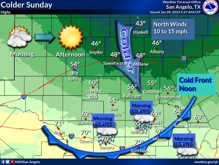
From KOXE meteorologist Randy Turner – While we enjoy our weekend, we should also start monitoring the weather closely for early next week as Old Man Winter makes a return visit to our area. Colder weather returns Sunday (Jan 29) when a cold front sweeps through and opens the door to much colder weather for the coming week and a potential for rain and precipitation of the frozen variety. Expect the cold front to arrive Sunday morning after sunrise but before noon causing high temperatures in the 40’s Sunday afternoon. There could also be some light rain when the front moves through. Look for lows near freezing Sunday night, highs only in the 30’s on Monday and lows in the 20’s Monday night. Tuesday, the highs are forecast to be 31-35. Complicating matters is precipitation which is expected Monday through Wednesday. Given temperatures sub-freezing, I’m concerned that we could experience freezing rain Monday night and Tuesday, maybe Tuesday night. Freezing rain means icy roads so early week winter mischief is something to consider and plan for, especially Monday night through Wednesday morning. I plan to send out another update on Sunday.