
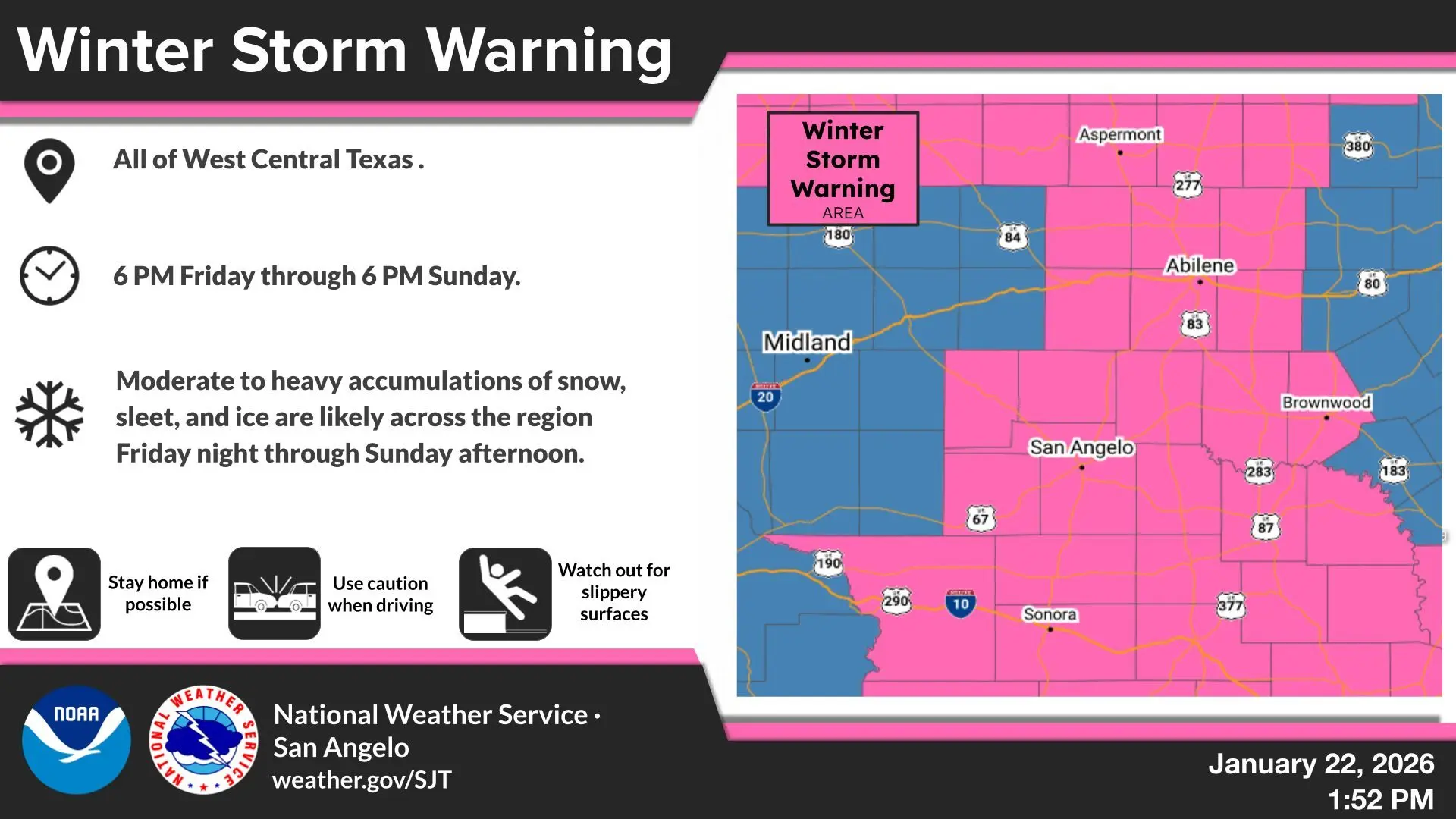
The National Weather Service as of 11:30 a.m. Thursday has issued a Winter Storm Warning from 6 p.m. Friday, January 23 until Sunday, January 25 at 6 p.m. An Extreme Cold Watch is also in effect from Saturday morning through Monday morning
* WHAT…Moderate to heavy accumulations of snow, sleet or ice are likely across the region Friday night through Sunday. In addition, dangerous cold temperatures are expected Saturday night through Monday morning.
* WHERE…Fisher-Nolan-Sterling-Coke-Runnels-Irion-Tom Green-Concho-Crockett-Schleicher-Sutton-Haskell-Throckmorton-Jones-Shackelford-Taylor-Callahan-Coleman-Brown-McCulloch-San Saba-Menard-Kimble-Mason counties
* WHEN…From 6 PM Friday to 6 PM CST Sunday.
* IMPACTS…Roads, and especially bridges and overpasses, will likely become slick and hazardous. Power outages and tree damage are likely due to the ice. Travel could be nearly impossible. If you must travel, keep an extra flashlight, food, and water in your vehicle in case of an emergency. The latest road conditions for the state you are calling from can be obtained by calling 5 1 1. For driving conditions across the state of Texas, visit DriveTexas.org for more information.
Persons should consider delaying all travel. If travel is absolutely necessary, drive with extreme caution. Consider taking a winter storm kit along with you, including such items as tire chains, booster cables, flashlight, shovel, blankets and extra clothing. Also take water, a first aid kit, and anything else that would help you survive in case you become stranded.